Description
Development of Products & Services in the frame of the project’s “Forest Task”. Monitoring and Management of the Environment at International, Regional and Local level, according to the applicable regulatory and legal framework. Satellite (multi temporal / multi resolution) and other (DEM, forest inventory data, etc) data usage, with the aim of monitoring forest ecosystems of southern Europe.
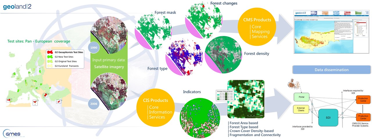
Design Development and Implementation of Core Mapping (CMS) - Core Information Services (CIS) and generation of relative Very High Resolution (VHR) layers:
- forest - non forest mask
- forest type map
- forest density map
- forest mask changes - forest type changes & forest density changes
- environmental indicators
Pilot study areas:
- Portugal - Spain
- Malta
- Bulgaria - Greece
- Cyprus
http://www.copernicus.eu/projects/geoland2

