Description
The GSE MarCoast (Marine and Coastal Environment Information Services) refers to two application areas: (a) Monitoring of Oil Spills and (b) Evaluation of Water Quality in coastal areas.
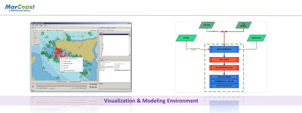
This project complements the information provided by the individual actions, since the information about oil spills in conjunction with SAR images "feed" the system (under development) by seeking the support of the operations for identifying the responsible(s) for a pollution event.
The system uses (real time) data for the dynamic monitoring of maritime traffic (AIS and VTMIS) in conjunction with space observations (SAR / ERS-2, ENVISAT) and information from maritime surveillance operations. To meet specific operational needs of the Hellenic Coast Guard, the design and development of the system was based on ECDIS (Electronic Chart Display and Information System). The operation of the system supports improved knowledge on shipping and allows for timely decisions for: a) locating suspect for illegal entry vessels, b) identification of ships which may assist rescue operations & c) detecting ships suspect for environmental damage (water pollution).
http://www.copernicus.eu/projects/marcoast

