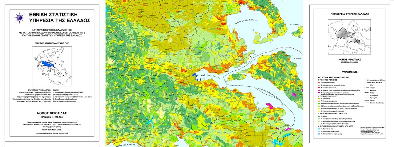
Description
Small scale (1:100.000) Land Use / Land Cover mapping using satellite data for the Regions of Attica, Sterea Ellas & Euboea, Thessaly and Epirus.
Design and Implementation of a sampling scheme and definition of the ground data collection sample. Generation of the photo interpretation keys. Implementation and realization of comparative photo interpretation to assess limits and areas for 16 ‘generalized’ CLC categories.
Photo interpretation precision check.
Statistical evaluation of the precision of the photo interpretation on a Prefecture level. Map composition and printing of thematic maps and attribute tables (land cover/use areas) on a regional and prefectural level.

