Description
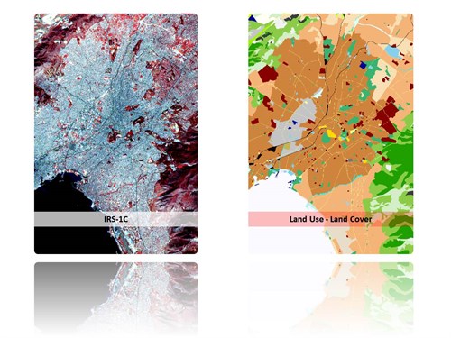
Land Use / Land Cover mapping of the urban area of the Attica basin according to the CLUSTERS nomenclature through appropriate processing of high and very high spatial resolution satellite data. The project was realized to fulfil EUROSTAT’s needs for establishing homogeneous and harmonized information of the urban areas across the European Union.
Design, Development and Implementation of an appropriate methodology for automatic and "objective" mapping of big urban agglomerations, following a common set of specifications.
Pan-sharpening of SPOT XS data with the Pan channel. Design and Implementation of a sampling scheme and generation of the photo interpretation keys.
Development of specific algorithms (texture), for the classification of the HR and VHR images.